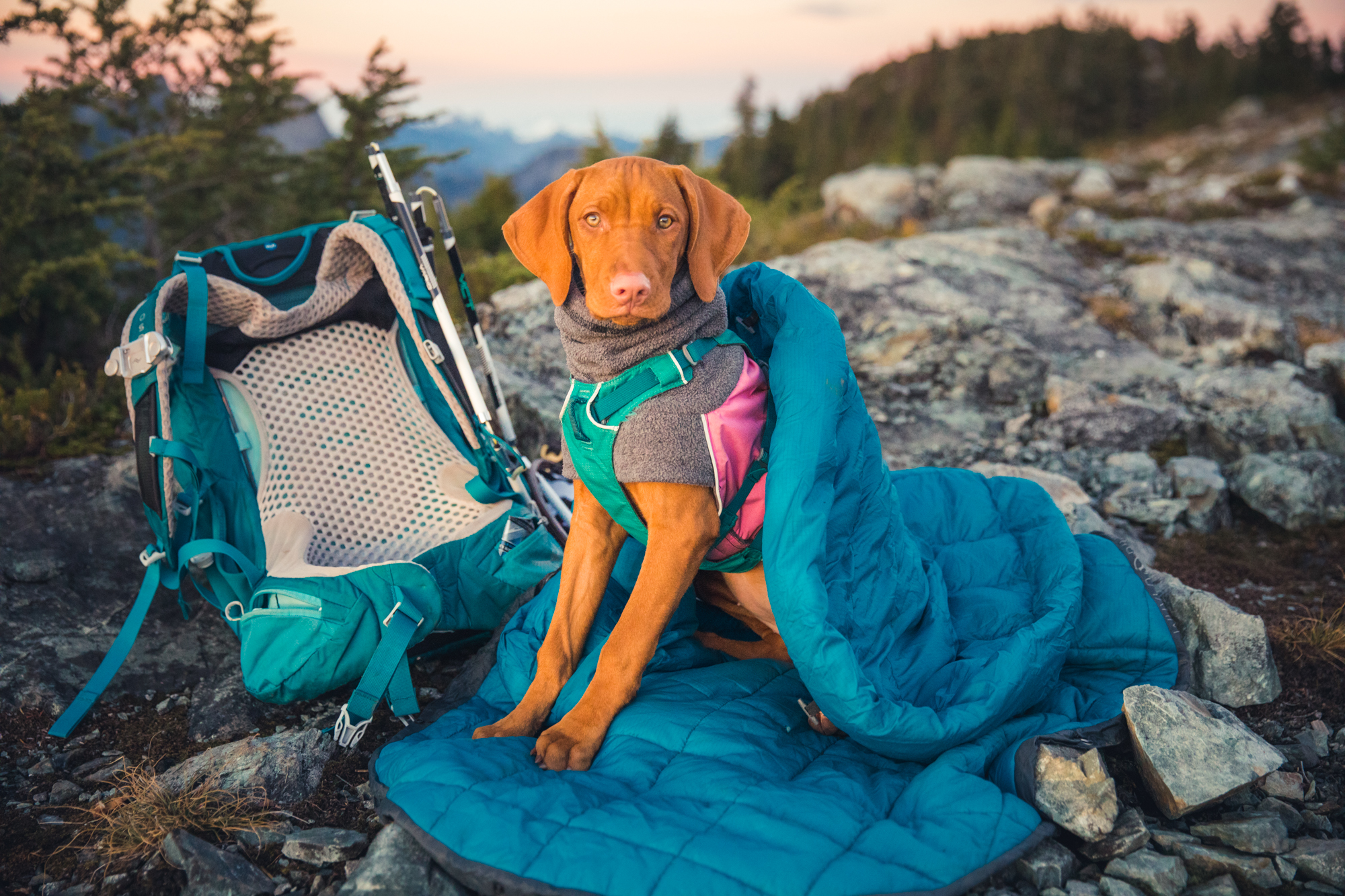
These items should be on your hiking checklist! Optional gear is in GREEN, Seasonal gear is in BLUE. This is assuming something like an 8 hour alpine hike in the backcountry with no reception and a dog.
10 essentials for any hike 1. Navigation 2. Headlamp 3. Sun protection 4. First Aid 5. Knife 6. Fire 7. shelter 8. Extra food 9. Extra Water 10. Extra clothing
When I passed by this section of Northern BC a couple years ago, I looked at the parks nearby and made a mental note to research more for a multiday hike in the future. Just the photos of the Spectrum range alone makes one spend a couple hours looking into the possibility of checking out this region.
The bright colored mountains drew us in
Previously called the Rainbow Mountains, the range is so colorful from the heavy mineralization from the Mount Edziza volcanic complex. As well, this location is the main source of obsidian in Northern BC and First Nations travelled from as far away as Alaska and northern Alberta for the sharp stone.
The wild Spectrum range
There are very few trails in the region, mostly not marked, often overgrown and always difficult to hike. There’s two main areas in the Mount Edziza Park, the Spectrum range (South of the Raspberry Pass) and the Edziza area, neither of which has vehicle access, all very remote, and home to Grizzlies, moose, mountain goats and sheep, and wolves.
The little plane that took us in, and all our gear
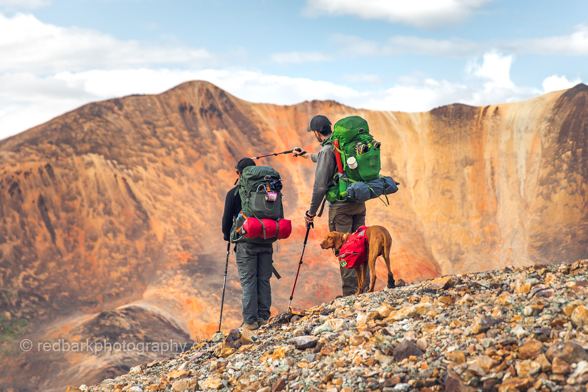
With little information and no trails, we made our own trail plan, traversing from Little Ball Lake to Mowdade Lake in a U-shape heading over the range. Everyday we passed by one or two mountain ranges, and normally crossed at least one river/stream. Our maps were old (glaciers having receeded a large amount) but with barely any trees, we were able to find our route relatively easy. Scrambling passes were more difficult, as sometimes you would climb most of the way up a mountain only to pop over the other side and realize you couldn’t get down safely. Another time we scrambled up a pass with loose scree that just kept getting steeper to the point we ended up climbing up a waterfall as it had the largest stable rocks to cling to.
The crew, 3 humans, one pup
River crossings were another challenge and there was a day we reached a river towards the end of our day. We could have camped and then attempted the crossing in the morning, but we chose to attempt the crossing in the evening in case someone fell in and needed to spend the day warming up. The river was ranging, and we scouted until we found a narrows (which made the river even faster). There was a 1 meter jump that could not be missed. Packs were thrown over separately and Whiskey made it on her own (with alot ALOT of encouragement and a rope tied to her harness).
Vistas were at every turn
Water was everywhere, and filtered it was clean and easy to cook and drink with. We never needed to carry much with us, as everyday we would pass countless sources of water or snow.
Limited food supplies but still yums
Finding suitable camp spots was also easy, the main question being, “should we keep going, would it be better further on”. We buried our bear bags (Ursacks), with all our food overnight far from our camp spots and never had any issues. We carried dehydrated food packs, and with very limited spaces in our ursacks (the determining factor in what we could bring), packed dried fruits, bars, and shared double
Whiskey and the humans were exhausted every night
Communication became key, as our last day ended up being longer than any of us expected (with no trail, we didn’t know how long anything would take). With my InReach mini device I was able to speak to our plane for a pickup as late as possible. We were racing the sun as we finally got to Mowdade Lake (with a couple wrong turns) and boy the elation when we saw our plane picking us up!
The most loyal, strongest, sweetest trail dog everHanging out above glaciersWhat a wild country
Tinhat Hut-> Elk Hut-> Walt Hill Hut// Fiddlehead Landing -> Dixon Road
The Sunshine Coast trail has been on my “must do” list for a couple of years now, and it was only recently I finally put aside all excuses and found a crew who were keen to try. We were all photographers who had weekdays free, and since I don’t go without Whiskey, I wanted to ensure that it would be the least busy on the trail. Scroll to the end of the article for map links and other resources!
The Sunshine Coast Trail
The Sunshine Coast trail is located on the northern Sunshine Coast which involves 2 ferries from mainland Vancouver. With the timing of the ferries and the drive across the Southern Sunshine Coast, parking at the end of the trail, and shuttling to the beginning being so time-consuming, we decided to sleep over at Egmont, near Earls Cove. This way we could pick up an early ferry and have a fresh start at the trail the next day, freshly showered and with a good nights rest. There is also so much to do on the drive to Egmont, so we checked out one of my favorite spots, Smuggler Cove, and reached our cabin at the BackEddy well before sunset.
Smugglers Cove Sunshine Coast
In the morning, we took off early and headed to meet Jesse of the Sunshine Coast Shuttle Services so he could help drop us off at the beginning of the hike (this way we could do a one-way hike to reach our car). We parked around the 137 km mark of the trail and he shuttled us to Fiddlehead Landing with his truck (dog friendly, yey!). We hit the trail in the rain, knowing that our first day was over 1100m incline with full packs.
Ask Jessie to shuttle you to the start of your hike!
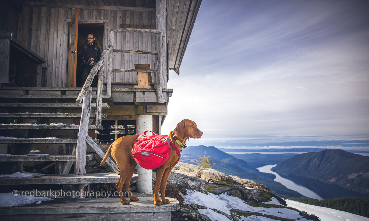
Pretty soon we were seeing views between trees and with a couple sketchy log crossings and some very muddy patches. Eventually we made our way to a huge junction at km 88 where the trail meets a rugged forest road. Going straight would keep us on the SCT and turning right would take us a couple kilometers to the Tin Hat hut and some pretty epic views. The snow started around this point and we kept climbing until we finally broke through the trees when Brice, who was (usually) in the lead saw the first glimpses of the cabin. I was sooo happy to drop my pack at the hut and magically the sun came out and lit up the best views on the entire trail. We had slammed this section, of around 9km in only 3 hours 45mins (including breaks) so we had tons of daylight left. A benefit of off-season camping is that the snow meant we didn’t need to go off in search of water (there is no water source at the cabin normally). Also, sharing a tight space with a dog (even a short haired, well behaved and non-smelling one) can understandably be difficult for non-dog lovers, and so I also go out of my way to go to huts off-season.
The cabin is small, but well built and would be cramped with about 8 people in the loft. It sits on the best views of the trail and has a compositing outhouse in really good condition. There is a wood pellet stove to keep warm and even in the spring, there was more than enough pellets for a couple months more. We even had reception! After a really well deserved dinner we grabbed our cameras and headed out to the view point for sunset. Crampons really helped as we were making fresh tracks and we were rewarded with one of the best sunsets yet this year!
Sunset at Tinhat peak
After a really warm night’s sleep in the winterized cabin loft, we took our time eating breakfast, making lunch, and headed out. The weather was calling for rain in the evening so we tried to keep moving. There are two options to head to the next part of the trail, the quicker South trail, or the longer trail that loops around Lewis Lake. The Lewis lake trail was unbroken snow and is a scramble in sections, and also adds about 5kms but is more scenic and avoids some of the logging roads. We chose the south route because of the snow and the weather. About the halfway point, we had a quick lunch break at Coyote lake where the sun popped through he clouds for a couple minutes, and then kept going, arriving at Elk Hut just before the downpour started in earnest.
The crew
Elk hut is an open hut, with 3 sides walled in, and one open. The loft is also open to air, so it was going to be a chilly night. On a dry summer day, I can imagine this would be a lovely place with a firepit outside (that was totally soaked), places to hang out, and a log dock. We even saw a canoe underneath the cabin but as it was pouring rain our whole time there, we didn’t get to enjoy it much! To warm up, we quickly changed into dry(ish) clothing, boiled up some water for tea, cooked up some dinner and crawled into our sleeping bags really early hoping for an early head start the next day.
Not happy it was raining
13 hours later, we crawled out of our bags back into rain. I suppose we had been pretty tired from a cold day’s trek so we all slept really well. After breakfast and packing up again, we started to our last hut of the trip- Walt Hill. It looked like this would be our easiest day so far, and most of the hike was lovely but as soon as we hit the snowline, everything changed. Although this section is lower in elevation than Tinhat, the snow was deeper and softer so we spent what seemed like an eternity taking turns breaking trail and post-holing up a path that no one had visited recently. The views are really nice on this section, and I can imagine without snow this would be one of the best parts of the trail to hike. When we finally saw glimpses of the hut, we were absolutely elated to have 4 walls and a fire to warm up and dry out for the evening. We had about an hour after reaching the Walt Hill hut before the rain really came down again. We still had lots of snow so we didn’t have to worry about a water source once again and huddled inside drying out the shoes, socks, and clothes for the evening.
All the snowall the shoes and socks drying
Our last day on the trail was calling for the a downpour, so I threw on all the rain gear, packed up my camera deep into my bag, and raced down the mountain thinking only of that dry car! Thankfully it was a quick section on a very well marked trail with only a couple water crossings (which probably aren’t anything on a dry day). We cheered at every kilometer marking (or at least I did!) until we reached the road where I parked and all scrambled into the car making really good time (2 hours 50 mins 12 kilometers).
View from Tinhat
Overall I would love to do this trail again! I really recommend it for those that aren’t as comfortable tenting in bear country, or would prefer to shed the weight of a tent and have a roof and space to sprawl out in the evenings. I can imagine the huts would be pretty busy in the summer and could be quite tight in space if there were too many people (it has been full on weekends in the summer). There isn’t a way to book the hut, so plan accordingly by bringing a backup tent or aim for a weekday (or day when the weather isn’t great). Definitely take advantage of Jesse’s shuttle service and ask him questions when you are in the car about the conditions and trail reports he’s heard about. Also please consider donating to PR PAWS who maintain the trail and huts if you are using the trail.
With the speed of our road trip, we didn’t have much time for backcountry adventures but we did want to do at least one overnight trip in a beautiful location (especially since we had brought our backpacks and gear). Tombstone Territorial Park is one of the most accessible northern parks, and not only are the mountains and tundra jaw-droppingly beautiful, it’s also home to moose, caribou, bear, Dall sheep, marmots, ground squirrels, and loads of falcons and birds. Since it is located at the base of the Dempster road, we would be passing through the park twice and were a bit more flexible on camping dates. This was necessary because the Tombstone’s Grizzly lake site was almost booked out for a week (max 10 sites), and we were able to secure a spot a week later after on the return from the Dempster.
a really cute marmot
Amazing scenery on the way to the site
The mountains surrounding the campground behind us
some rocky bits to travel through
Carrying her share!
Just really beautiful!
When you overnight at Grizzly lake, you must pick up a pass from the Interpretive Center and also a bear container. Why they don’t just keep the containers in the camp site’s bear lock-ups (as they do in BC) is a bit beyond me as they are large and hard to pack and heavy. We had a little intro to the hike with a very friendly ranger, loaded with lots of warnings and were given estimated hiking times that were really quite extreme (8-12 hours one way). Just as a reference, we asked lots of hikers along the way and campers at the campsite, and got an average one-way time of about 5-7 hours (but we didn’t meet too many older hikers). Without a backpack I would estimate one could do a return trip in about 9-12 hours with lots of breaks and rests. We finished in about 7 hours one way with about 1.5 hours of total rest and photography time.
Starting in the subalpine
the first section is a climb and you get views quickly
up up and up!
saying hi to some rangers at the top of the first incline
having no issues with the “tough” terrain
lots of resting and photos
The highest point of the trail
The terrain is varied and beautiful with lots of changes but is not technical and the path is very easy to find and follow. A hiker from Vancouver wouldn’t have a problem at all, but I can see that anyone not used to mountainous inclines might find the hike difficult with a full pack. We kept Whiskey on a leash most of the time as we passed by lots of marmot territory but did have to let her off where being attached to a leashed dog is actually quite dangerous (jumping over large boulders and areas with exposed sides). In these cases, for us it’s safer to let her find her own path since one wrong pull from a larger dog could bring you tumbling (and also we are used to off leash hiking so Whiskey is also safer as well).
You can see the campground coming up! more than half done
Whiskey pulling her daddy along
You can see the lake clearly now
A tiny bit of snow left in July, with the most amazing views
At this point everyone is tired of me taking pictures
rocky sections separate a couple marmot meadows
The campsite was really muddy and had roped off trails to and from the eating shelters which was really the worst part about this entire trip, but at least the camp spots were raised off the ground (great for squirrels not to eat through your tent). Ground squirrels are famous for eating through everything since they are so salt-deprived and will even eat your shoelaces if left outside of the tent. It was not advised to use the lake water, rather the running water from the streams on the way to the campsite but we saw people using the lake water with filters. For Whiskey’s food we packed her dehydrated dog food which she of course, carried herself.
Walking through some meadows
ground squirrels are really chirpy!
marmots shrill as we walk by (keep dogs on leash!)
They blend in so well here!
Living in paradise
a pointer doing her thing
lots of breaks to look at the scenery
mom! enough pictures!
watching us set up camp
at the food shelter
waking dad up
the hardest part is getting up when it’s cold and rainy
Overall we were extremely lucky with the weather as we only had a sprinkling of rain on the trail, but once we set up the tent for the night and started cooking under the shelters, the rain started coming down in earnest. It rained the entire night, but in the morning it stopped just long enough for us to hike back (and started again when we got back to the car).
a mini waterfall for collecting water
massage stops along the way, of course
Heading back was much faster
I still couldn’t get enough of the scenery
looking back down at the rest of tombstone
We are tiny in a beautiful Earth
Just missing the proper rain, but we had a few sprinkles
the entire trail has views except for the first km
The trail was easy to follow with no chance of getting lost
Racing to the car before those pregnant clouds let loose!
There were many options for a 3rd and 4th night, unfortunately, we didn’t have time and headed back . Quick doggy cheat: Thierry attached Whiskey’s leash to his pack, and then to his belt so she would power him up the inclines. It’s a bit trickier heading down though! On the return trip we were an hour faster (and took fewer photos) and just arrived in time to drive back to the Interpretive Center to return the bear can before they closed. I’d love to come back again!
For our next camping adventure, we stole Whiskey’s sister Sophie and headed off to E.C. Manning with a bunch of friends. I’ve heard so much about this park and was just waiting for a good weekend to go. This was the last weekend before reservations started to book the campsites so I was hopeful that if we arrived at a good time on Friday, we would be able to grab a couple good camp spots for our larger group. We picked Lightning Lake to camp at, since it was the largest and I thought the best chance at getting a couple spots and finding our friends. Campsites were surprisingly expensive ($35/night) with a max of 4 people and an extra $12 for another car. I suppose the facilities made up for the price though, with self flush toilets, hot showers, and lots of bins and water taps everywhere. The rangers even drove around delivering wood (at a high fee of 8$/bundle).
our two guard dogs
playing all day long
Campsites at Lightning lake were a good size but still too close to neighbours to have off leash dogs. We brought the long line so the dogs could still run and play and got to work on drinks, bbq and setting up tents.
morning wake up call, lining up at the “door”
morning walk
A very Canadian scene
Whiskey and Sophie had to get used to their new accommodations but then happily fell asleep in a dog bed (Sophie) and my sleeping bag (Whiskey). Of course they woke me up at sunrise for a walk the next morning but I really couldn’t complain once I got up and saw the beautiful scenery.
The view from the road leading up to Blackwall Peak
our camping group
dogs checking out the view
walking up to the parking lots
really nice views!
checking out the views
Sophie approves
catching snowballs in June
best game ever!
not a bad weekend!
heading back
all clouds lead to Whiskey
Lightning lake from a viewpoint
Once everyone else was awaken and we finished an extravagant breakfast, we attempted the 3 Brothers hike but didn’t realize the road to the parking lot was closed. Instead, we walked the 1 hour on the road to the parking lot and took in the views of the still-snow-covered trail.
Paddleboard with dad
getting a taxi around with the girls
not sure what she’s pointing at
ground squirrels keep a watchful eye
photoshoots with Whiskey
Just a regular at the camera
posing on a board isn’t easy!
Sunset on the water
It was a really hot day so after that we headed down to the day area of Lighting Lake and hung out in the glacier waters until sunset. Whiskey had a couple goes at the paddleboard (we took turns taxi-ing her around) and the dogs were happy just lying in the sun or pointing at the ground squirrels.
campfire after dinner
sleepy in front of the fire
eating way too much food
Back at camp we toasted marshmallows, ate way too much food, and just enjoyed the fire. The dogs were so fully exhausted from the day that they went into the tent and fell asleep on their own (success!). Again, the next morning I took them for their sunrise walk and this time walked a good distance around part of the lake.
morning walks
sunrise with the girls
glacier water is gorgeous
my little poser
chase on the trails
fetch is perfect when it’s this hot!
ear massages while lying on her blankets
This is the life of a Vizsla
Once the group ate breakfast and made some sandwiches for lunch, we then headed again to the day area where some suntanned, some others floated on various items in the water, and a couple of us (including dogs) did the hike around the lake. We headed back home after that with a car full of tired Vs and humans.
If the Grouse Grind is not your cup of tea… because it’s too busy, too short, too easy, and the views aren’t very good, then this one is a splendid alternative. Just a warning though, this is not a good hike for beginners or those not inclined to climb 1250m over 3kms for fun (or as the graffiti on the sign says “hard as fucking hell and not for beginners”. Mt Unnecessary is one of those beautiful peaks on the Howe Sound trail between the Lions and St Marks. I’ve previously conquered it on the way to the Lions from St Marks years ago, but never from it’s own dedicated trail starting at Lions Bay.
The divide to Erin Moore Trail (dedicated to a 7 year old who died on the trail in 2014)
Happy in her element
mini breaks on the relentless climb
Steep! Steep!
kisses on a fallen log
This way!
We weren’t able to finish the beast (about 250m higher to go) because of snow but we still got some beautiful views, a wonderful lunch spot, and the perfect workout all the while having the entire trail to ourselves.
Views halfway up
Looking down you can’t even see the trail
beautiful and quiet here
Little ginger watchdog
Whiskey had no problems with the rocks
watch your steps up and down
Waiting for us slow humans
This hike is very to-the-point and unrelenting but also has enough variation and interesting scrambly sections to keep you interested going up. Because it’s so steep, you climb altitude really fast and start seeing promising views within an hour. I’d like to think I’ve done quite a few steep hikes and this one is pretty up there on the list, for a dog-friendly one.
More little breaks
Lots of fun!
A beautiful long-weekend hike
not a bad spot to eat
The view NorthWest of Lions Bay
Coming down was harder and longer than expected and I was really tired of falling on my butt. The steepness, loose ground, and my knee injuries were a bad mix but we still made it down in one piece (Whiskey was wondering what the big deal was and why we were so slow). In all we finished in less than 6 hours and were happily sore the next day!
Getting to need snowshoes/crampons
Whiskey loves running up and down with sticks
I slid on my bum down, while Whiskey ran her but off
Since the weather’s turned a little drier, we took the opportunity to plan a couple higher-altitude hikes where we might have enough luck to catch a view these cloudy days. We tried to head towards St Marks but was turned away by avalanche warnings so then turned to our trusty Eagle Bluffs hike that I’ve blogged about several times already.
Dad! There are snowboarders to chase there!
lots of warnings
fetching over a mountain of snow
throw it! throw it!
my ginger girl
the steep start is a good workout
The ski slopes were surprising still open so we still had a get a “backcountry pass” for access and then we quickly headed up the snow-covered trails alongside the skiers. Crampons were very useful and Whiskey had more than her normal amount of energy chasing snowballs up and down the mountain. You would think 3 hours of running in snow would tire her…nope!
views come quickly as you climb
so excited to be out
following the boys
perfect temperature for a hike
footprints of a mysterious animal…
in some places the snow was still deep
best place for a dog!
the one soft spot in the forest
The clouds parted just as we got to the bluff where we had a nice lunch and rest before heading back. I love these shoulder seasons as the paths are not yet busy on the more popular local trails. When the crowds start coming up, we move to lesser-known trails but those are usually harder to get to.
really nice walk around the lake loop
melting snow is so beautiful and Whiskey explores
we finally get to the top!
Whiskey as usual, had no idea why her humans were so slow and awkward coming down the slippery trails, and would try to give us kisses as we sometimes slid down on our bottoms. The best part of snow covered steep trails is the quick slides coming down. We are just waiting for a little bit more melting before heading up towards higher altitudes soon!
Did I mention that we ended up in Washington during a crazy snowstorm? We almost lost Whiskey except for her day-glo jacket in the snow (chillydogs.ca). She can barely surface to breathe…joking!
So I’ve seen so many beautiful photos online of this park and I was really excited to visit. Unfortunately, the worst part about this beautiful snowshoe is the parking price!! You must get a confusing number of two passes (sno-park pass and discovery pass) the total of $30 USD, for just one day of parking which becomes a very expensive hike (and we did see rangers who were checking).
Otherwise, the park was lovely and empty besides a couple cross country skiers, and a couple visitors just taking pictures at the entrance of the lake. I suppose no one brought their own snowshoes to explore for we explored a very easy snowshoe trail with interpretive signs and met no one. The trail would normally be very easy to follow had we not had 50cms of fresh snow, but even then we had no problems at all once we found the “start”.
From the amount of photos online of this lake, I would suspect this park is normally very popular and busy. Here’s to getting outside when everyone else is sleeping in after a snowstorm!
In fact it was so beautiful we went a second time while waiting for the highway to open up again on our way out (there are alot of closures with the snow storms). Here are some photos the day later.
This Christmas holidays my mom visited and we took a little trip into Washington state to get away from the rain and into some snow. What we hadn’t anticipated was the amount of snow! Our first stop was Mt. Baker and with a fresh snowstorm, most of the trails we had wanted to try had vanished into hip-deep fresh powder hidden by 7 feet of snow banks. We did try our hardest to visit Picture Lake but this is about what we saw (assuming we were looking at the lake and not on top of it!)
This is Picture Lake (we are probably on top of it)
Even with snowshoes we were sinking
Mom wasn’t too amused by our attempt to hike
Whiskey was quite happy for her jacket!
We eventually found a really nice and easy mom-friendly snowshoe trail to try at the Salmon Ridge Sno-Park. The trail was called Elk Snowshoe trail and crossed a couple cross country trails.
Elk Snowshoe trail had much less snowfall
the trail wasn’t very well maintained but it was easy to follow
the little balls of snow are covered pebbles
on leash while the drone flies!
There was only one other car in the parking lot and we met no one on the snowshoe trail.
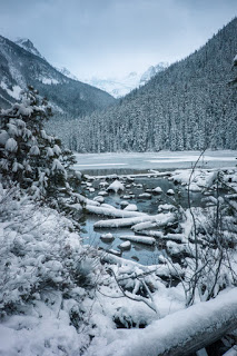
The river is so beautiful
A very nice easy trail
The road to Glacier town
The trail itself was very flat and easy with a couple obstacles and was easily done in crampons or snowshoes. The part along the river was fantastic and we even got a little drone footage.
I’ve been wanting to do this hike for years now and have been finding multiple excuses not to (the distance drive from Vancouver, the crowds, the rain). Finally, I got lucky with a break in the rainy weather and a free day with nothing planned. We woke up rather early as our sun sets now at 4:30 and drove the 3 hours up to the start of the hike (including a coffee stop). There were already cars up and down the stretch of highway that led to the parking lot, but the parking lot wasn’t full of cars because instead it was full of snow! We parked right next to the trail and Whiskey jumped out super excited about the white stuff, amusing all the day hikers while we got geared up.
the parking lot and start
kisses on the way to the camp ground
The first lake is a tiny walk from the parking lot, but even then I would suggest well soled boots if there is snow. Assuming you are planing on the hike past the first lake, I would highly recommend crampons because although the trail is very packed, it’s extremely slippery and you will spend most of the time back on your butt if you don’t have spikes. Although my sweet Vizsla was initially excited about snow and was fine while moving on the trails, she did get chilly if we stood still too long (like while waiting for a drone flight).
first lake
just really beautiful everywhere
the trail is very easy to follow
catching snowballs (sort of)
I really couldn’t believe how fast winter had hit here and everywhere I looked I was smiling at a winter wonderland. We took the drone for a couple spins but otherwise hiked up to the 3rd lake in a much faster pace than websites have you think. Because of the weather and season, the hike was less populated than normal but on weekends I hear it is a line-up and you must get here very early to find a camp spot. In the winter or shoulder season though, you may still find some moments to yourself and we were so happy we came despite the long drive time.


