Category: Roadtrips

  • Guide to Beaches and Paddling Lakes on the Sea to Sky Highway

    Guide to Beaches and Paddling Lakes on the Sea to Sky Highway

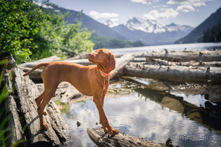
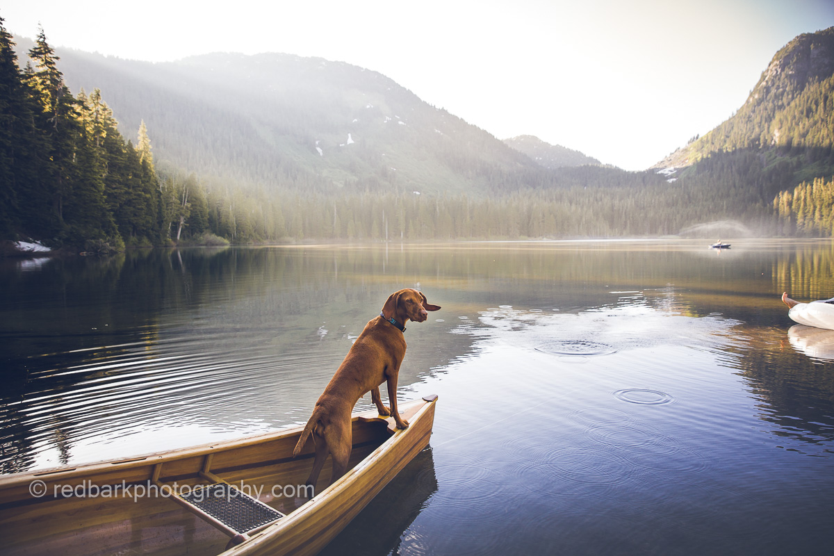
    The Sea to Sky Highway linking Vancouver to Whistler and Pemberton is one of the most beautiful drives in the world. Weekend warriors load up every Friday evening and fill up the parking lots to every easily accessible lake, trail, and park along the road. Here’s a guide to the Lakes and beaches of the Howe Sound along the highway, and places I like to take a kayak, paddleboard, or canoe with my two Vizsla dogs Whiskey and Bourbon.

    Many of these places do fill up quickly on weekends and parking is not allowed on the highway so I would suggest weekdays or very early weekends to get a parking spot! The guide moves from Vancouver to Pemberton and is location based. Check the tides for anything in Howe Sound and wear a life jacket! In case you’re a dog owner, here’s a blog on how to get started paddling with your dog.

    🚗 Car Access
    🚶‍♂️ Walk to Access
    💪Hike to Access
    🚽 Toilets
    🗑️ Garbage Bins
    🛑Difficult Parking
    🚫No Dogs

    Vancouver-Squamish

    Whytecliff Park 🚶‍♂️🚽 🗑️ – The access is down a set of stairs and a rocky beach. Check the tides before you go! There are seals, periodic whales, and an islet (island sometimes connected) to paddle around. Sunset is gorgeous. This is also a common diving spot so watch for divers! Bathrooms and a small food concession is on site as well as a small trail, green grassy space.

    Kelvin Grove Beach 🚶‍♂️🗑️- Lions Bay Beach Park may be preferable for those without dogs, but Kelvin Grove Beach is Dog Friendly. There is paid parking, and the access is down a short trail to a small set of rocks with logs. Depending on the tide you will have more or less beach to launch from with your dogs. No bathrooms.

    Porteau Cove 🚗🚽 🗑️ -A much larger beach and area to launch from. There is a campground connected to the beach as well as a large dock. Bathrooms are available and there’s lots of places to launch especially when the tide is low. Very quick and easy access from the car to beach.

    Furry Creek Beach 🚶‍♂️🚽🗑️- There is less parking and a bit more walking involved than Poteau Cove to the beach access at Furry Creek Beach, however because of this the area is a bit more quiet. There is very little beach on high tide so be aware!

    Squamish-Whistler

    Mamquam Beach 🚶‍♂️-in Squamish is currently under a series of construction so it’s hard to tell how access is lately. Right now there’s a decent walk to the beach from easy parking downtown Squamish but the beach has the best view of the Chief especially during sunset.

    Spit Road 🚶‍♂️- in Squamish has lots of options to park and launch a boat, however be warned that the river can move quickly and you’ll likely be hiking your way back up the road when you’re done. Have knowledge of river paddling, the waterflow, and tides before putting into the Squamish River (especially if you’re going to drop in further upstream).

    Alice Lake 💪🚽 🗑️ – Alice Lake Provincial park has 4 lakes. The easiest accessible lake for paddling is Alice Lake itself but it’s not dog friendly (even the trails around the lake prohibit dogs). Stump Lake is the easiest accessible lake for paddling with dogs and is quite quiet for boats and swimming even on a busy day.

    Cat Lake 🚶‍♂️🚽🗑️ – Cat Lake a small lake with loads of docks. It’s great to practice paddling as it’s so small with so many access points and lots of parking. Even so, on weekends the campground fills out and it can get extremely busy. An AWD is advised as the road can get rough and in winter it can be impassible. Boat access is a short walk down a wide trail to the main dock. There are pit toilets at parking and lots of garbage bins.

    Brohm Lake 💪🚽- Brohm lake has very limited parking, especially in the summer weekends. There can be a lineup of cars waiting to get in further up the highway. It’s a long narrow lake and water access isn’t the easiest. If you take the trail going south from the parking lot, you get to the lake quicker but you’re launching from rocks. There’s also water access if you walk up north but you’ll be hiking up and down big rocks. The area is beautiful and there are pit toilets up the North trail from the parking lot but no garbage bins currently (please take your garbage out!).

    Levette Lake 🚶‍♂️🚽🗑️- A beautiful lake up a FSR (Forest Service Road). You will need AWD on your car in order to get up the road and there’s limited parking. The water access is a short walk from the parking, which has garbage bins and pit toilets. There is very little “beach” to launch from and the area can get very busy on weekends. This may not be accessible in the winter and there are cougars and bears in the area.

    Hut Lake 💪🛑- 4.5km hike down a wider easy trail from Levette Lake. You can drive further up the road shortening this hike if you have a 4wd and if you have a monster truck you can drive the entire way to the lake HOWEVER I have seen several trucks attempt this and be stuck and it is not an easy location for someone to come pull you out! A much quieter lake because of the hiking access but with no toilets, bins, and extra cougars and bears.

    Starvation Lake 💪- Either 2.6km from the highway or 3.5km from Paradise Valley Road (AWD advisable). An easy walk down a trail to the lake provides a lovely paddle on a nice summer day. There is limited parking on the Highway and you’ll have to walk along the highway for a small stretch before the trail starts down. Paradise Valley can get busy with campers and cars as well.

    Lucille Lake 💪- Halfway to Whistler sits Lucille Lake. Again, busy on weekend especially with locals, there is a limited parking on the FSR over Chance Creek Bridge. There are two launch points that involve a short walk in. The further beach has a nice sandy beach, great to lounge or launch from. There’s also a huge questionable bike ramp on one side of the lake. With no toilets or bins, keep your dogs really close and don’t wander too far into the woods.

    Daisy Lake 💪🛑- A large lake on the way to Whistler but this one is NOT easily accessible. It’s also closed to organized recreational activity and BC Hydro has it damned so the water level changes radically.

    Callaghan Lake 🚗🚽- Callaghan Lake needs AWD access up a longer road filled with waterbars off the Sea to Sky Hwy. Launch access couldn’t be easier as you can drive right up to the lake to drop off a boat. The lake is large and surrounded by mountains. There are campsites, pit toilet but no bins.

    Madeley Lake 💪- Access by an easy walk off the FSR that leads to this lake. AWD accessible the last I checked (perhaps 4WD now) and less visited and paddled lake. Small beach access with wild camping, no toilets or bins.

    Whistler-Pemberton

    Alpha Lake 🚶‍♂️🚽🗑️- A smaller lake with a dog friendly area, Alpha lake has lots to see and like most of the other lakes can get busy on summer weekends. Being a smaller lake in an exclusive neighborhood, parking can be more difficult but there are so many lakes to choose from in this location.

    Nita Lake 🚶‍♂️🗑️ 🛑- A smaller lake that doesn’t have the easiest parking access. I Haven’t paddled this lake but there is a trail around most of the lake with access to drop a boat in.

    Alta Lake- 🚗🚽🗑️ With a dog-friendly beach, this is another beach I occasionally visit. The rainbow Park area has bathrooms, parking, and bins as well as a swimming area and dock. There are beautiful views of Whistler from the lake as well as lots of docks and big houses to check out.

    Green Lake- 🚗🚽🗑️ My favorite lake to paddle in Whistler. Green lake has easy access from many different trail and neighborhood parking along the lake. There’s also high end restaurants, chalets, and a gold course right by. Watch the seaplanes take off right in front of you (and please get out of the way!) and paddle around the gigantic mineral rich green lake.

    Whistler River– Golden Dreams Route- Paddle from Alta lake to Green Lake on this slow moving 5km route. You’ll see geese, maybe some bear, and lots of beautiful scenery. Aim for early summer as late summer the water can be low and you might need to portage a section. Check the water level before heading out as there’s a tricky section that might have you in the water. There are also tours you can take!

    Lost Lake– 🚶‍♂️🚽 🗑️ A lovely little lake with an easy beach to spend a summer day. Dogs are not permitted on the beach however but they’re welcome at “Canine Cove” 400m to the north.

    Pemberton and further

    One Mile Lake 🚗🚽 🗑️ – A lovely small lake with easy parking and beach access. The dock is easy to launch from and although the beach doesn’t allow dogs, no one has complained as we launched a boat with dogs from the dock. This is a lovely place to paddle for sunset and has lots of trails to hike when you’re done paddling.

    Lillooet Lake 🚶‍♂️🚽🗑️- The largest lake on this page by far! There are many access points along the In-shuck-ch FSR the easiest being Strawberry Point site with pit toilets, bins, and campgrounds. Access is down a dirt path to a rocky beach that stretches for a very very very long time. Because the lake is larger, pay attention to winds, however you can paddle here all day and still have loads to discover.

    Lower Joffre Lake 🚶‍♂️🚽🗑️🛑🚫- One of the most beautiful turquoise lakes, this park is now NOT dog friendly and also needs a day-pass. There is no reception at the lake so the pass must be garnered before heading up to the lakes and it is almost always packed. The lower lake is a short walk in and there is a small area to launch from. Pitt toilets and bins are available but sometimes both can be full.

    Duffey Lake- 🚗🛑 There is very little access to Duffey Lake but the area isn’t usually too busy. There are some places to pull over on the Duffey Lake Rd, or a viewpoint area on the East side with parking for several cars. The lake is huge and turquoise and surrounded by mountains. No bins or toilets, nor beach though!

    Seton Lake- 🚗🚽🗑️ Another absolutely gorgeous lake with limited parking access in the summer. If you’re feeling adventurous with a good car, you can drive around the lake and find quieter places to launch from or just to take photos.

    Birkenhead Lake 🚗🚽🗑️- Another provincial park with camping sites, toilets, and bins. The road is a bit rough but most cars can make it just fine, and I’m pretty sure there’s no reception. The area is beautiful with mountain backdrops and a beautiful lake. Perfect for swimming, there is a beach to launch from and it’s very easy to find a quiet spot to yourself on the lake

    Support my blog! Check out my little shop

  • Alaska’s Mint-Bomber Traverse with Dogs (and a Snowstorm)

    Alaska’s Mint-Bomber Traverse with Dogs (and a Snowstorm)

    Goldmint Trailhead to Mint Hut

    Deep in the Talkeetna Mountains in Alaska, a local favorite trail Hatcher Pass became world famous. Within the area, there are loads of options for hiking and exploration, but we only had a couple days, and very few days without an abundance of rain. My friend Kristina and our dogs Whiskey, Bourbon, and Cooper set out on a backcountry adventure exploring several huts and passes in the backcountry. As with most backcountry adventures in Alaska, our hike did not go according to plan.

    Bourbon’s first year with a pack

    First off was the 8 mile (13km) hike on the Gold Mint Trail to Mint Hut, where we planned to stay the first evening. The weather was beautiful and sunny (the only day it was!) and the hike in was the easiest part of the entire trip. We still did manage to get lost close to the hut, but we spent that time eating berries off the ground and taking photos so nothing very problematic. Because there had been so much rain, much of the trail was extremely muddy (re: a pond) so poles and waterproof boots were really helpful.

    Above Mint Hut, got a little lost

    When we finally found the hut, we spent the evening taking photos and enjoying the views. The clouds were coming in thicker so we were glad to have a hut to sleep in. Unfortunately the hut was also pretty damp and moldy smelling and all the pots and cups were pretty covered in black muck, so if you’re using anything stored inside, clean it well first. Also frustrating was the amount of dog poop left all around the hut. I’ve never experienced such poor management of dog feces on any trail or hut before (and that’s saying alot!) so PLEASE PLEASE pick up after your dog should you come here.

    Mint Hut exterior and views from Hatchers Pass
    Pick up after your dog here!

    Mint and Bomber huts are maintained by the MCA (Mountaineering Club of Alaska) so make sure you pay your yearly $20 fee online before you go. Because the weather had not been great, and we were at the end of the season (end of August), we were excited to try out the huts. Any of the huts along the route can be very busy so we brought an extra tent just in case, but luckily, there was only one other couple that ended up there that evening. With dogs, you must climb up a vertical ladder, or let them sleep on the ground. Our dogs are all smaller and hairless (and sleep inside our sleeping bags) so we had them up with us.

    Mint Hut interior and views from Hatchers Pass
    Mint Hut

    Mint Hut to Bomber Hut Via The Backdoor Gap (6.5km)

    This was so much fun! After Mint Hut, there are no more trails and you must be able to make your own way. You start heading up the steep scree boulder field heading towards the Backdoor Gap. The boulder field can be quite tough on dogs that are not used to climbing scree and rock. The rocks can rub paws raw, and the steep terrain can be dangerous if not navigated properly. Again, we didn’t take the most direct route, but we eventually did find the gap with extra scrambling and climbing and had quite a bit of fun doing so.

    Scree up to Backdoor gab
    Boulder field to Backdoor Gap

    The Gap itself is at the top of a glacier. You are climbing a small gap that can be snow-filled depending on the time of the year, or, in our case was currently snowing. Because it was so cold, windy, and snowing, we didn’t take too many photos and concentrated on descending. There were several questionable ropes hanging down that we used, but this section would be very steep for dogs.

    Backdoor Gap from Mint hut to Bomber Hut
    Kristina heading down the Backdoor Gap

    Next, you need to hike from the top of Penny Royal Glacier, all the way down. There were no crevasses we saw, and the glacier was pretty easy although quite slippery and was a nice break from scree climbing all morning. Eventually you drop down to the tundra and keep hiking until you find Bomber Hut. At this point it was starting to rain and we were quite tired from carrying our huge packs over the day.

    Backdoor Gab with Whiskey
    Kristina look over the Tundra heading to Bomber Hut
    Kristina look over the Tundra heading to Bomber Hut
    Bomber Hut and tundra in hatchers pass area
    Bomber hut in the background

    Bomber Hut was much nicer than Mint (although maybe not so pretty from the outside). It’s newer and with better airflow so it didn’t smell like mold. Again we were the first ones in so we made ourselves at home and started exploring outside between spells of rain.

    Bomber Pass from Bomber Hut, Alaska
    Bomber Pass

    The view from Bomber Hut were breathtaking. As the rains came and went, we were audience to moody lighting over an arena of mountain passes. Over the afternoon, more people came to join us and we had a lovely crew to chat with for the evening.

    Clouds coming in and out with Whiskey
    Bomber Hut
    Bomber Hut with snow

    Our next day, we had been hoping to hike to Snowbird Hut, however it was pouring rain and snow so we decided it would be nicer to take a day in rather than soaking everything we owned in cold rain for 5 hours without seeing any views.

    Kristina in Bomber Hut Interior
    Spending a day inside Bomber Hut

    We spent the laziest day in reading comics that had been left behind and chatting to the huge group of people that wandered through. Somehow Bomber Hut became the meeting place and over the day we had over 10 people max out the sleeping space. There were even several outside in tents in the drenching rain.

    Full House at Bomber Hut

    Bomber Hut To Reed Lakes Trailhead Via Bomber Pass (10.5km)

    Bomber Pass, Alaska
    Looking at Bomber Pass, hiking between these mountains up Bomber Glacier

    Since we changed our plans not to go to Snowbird, we ended up hiking out of Bomber Hut through Bomber Pass on our last day. We woke up to snow. So much snow! The snow turned to rain, but we could see at higher elevations it would be very very white. After a quick breakfast we started to head out and were the first group up the boulder field and onto the Bomber glacier to Bomber Pass.

    Bomber
    1950s TB-29 Bomber Wreckage and Memorial
    A plane wheel in a crevasse

    Bomber Pass is named as such because there is a TB-29 Superfortress Bomber Plane that crashed during a training mission in 1957 killing 6. Because it was snowing so hard, the other group that was heading up had decided to bypass the wreckage (it’s on the other side of the glacier). By the time we had located and explored the wreckage the other group had caught up to us and we were able to head up the pass to drop down onto Upper Reed Lake.

    A very snowy and rainy day

    The pass was quite dangerous with a new foot of snow that had fallen over the past day (making it 2 feet of fresh snow). Underneath the snow was pure ice and I hadn’t brought my ice axe so at one point I slipped and slid and slid, thankfully catching my foot on some rocks before I slid down a kilometer down the glacier. The top of the pass was totally covered in snow (snow covered rocks) so it became very very tricky to make our way up. Normally there should be a clearer path with rope but everything was so covered in snow.

    Bomber Pass in fresh snow
    Bomber Pass was treacherous with many injuries this day

    Upper and Lower Reed Lake

    Unfortunately since it was snowing so hard, we made our way through Upper Reed Lake and down through the boulder field only thinking about survival. Steep fresh snow covered boulders are a minefield and not fun on a sunny day. We were soaked to the bone with huge packs on and dogs to control. The snowy rocks are even more dangerous for dogs, especially inexperienced ones and a dog following us later that day tore a nail or toe and had to be carried the rest of the way. Someone else also injured their leg on the descent so be very methodical and careful.

    Once to Upper Reed Lake, the trails started again. I could see that normally these trails would be absolutely beautiful, but snow turned to pounding rain and we were quite tired from the pass so we just put our heads down and hiked out as fast as we could. Everything was so soaked my phone stopped working and our dogs were quite miserable. The trails had turned into muddy river that I fell in (and just laid my head down for a minute). Another area was so flooded with water that it was higher than my knee level when I sloshed through. I think my dog was swimming.

    From the parking lot we were able to hitch a ride to Mint Trailhead and were able to change our clothes and dry out finally!

    I would love to visit again!

    If you wonder why my bag was so heavy, check out here to see what I carry with me for camping. If you’d like to try out tent camping with dogs, here’s how, and if you’re looking for winter dog gear, first aid kits for dogs, or just other adventures, check out the links!

  • How to: the Unbelievable Moraine Lake with Dogs

    How to: the Unbelievable Moraine Lake with Dogs

    Moraine Lake

    One of the most famous and busy lakes in the world, Moraine lake is iconic and was featured on our older $20 bill. I’ve taken my Vizsla Whiskey loads of times for day trips and hikes and when I got Bourbon, my new Vizsla puppy, I took her on the 11 hour drive as soon as I got her.

    10 week old Bourbon could hike up the 350m to the Rockpile for photos

    Banff National Park

    Moraine Lake with dogs? Yes! Dogs are allowed in Banff National Park! Unlike the American National Parks, dogs are allowed on most trails and in the backcountry however there are expectations including times of the year for specific areas and trails.

    We love all seasons at Moraine Lake!

    Dogs must be on leash for many reasons including your safety, their own safety, and wildlife safety. There are loads of Grizzlies, Black Bears, Moose, Elk, and Porcupine to name a few. I’ve seen all of these animals within the park and I’m not a local! It goes without saying, please pick up after your pet, and keep your dog on a tight leash, under control around other dogs and all the chipmunks that beg for treats everywhere (I’ve never seen fatter chipmunks around).

    Elk, Moose, Bear, and Porcupine can all be dangerous

    There are lots of garbage cans and toilets at the parking and the National Park is pristine so please help keep it dog friendly for all of us!

    Getting there

    Moraine Lake is located in Banff National Park right on the edge between Alberta and British Columbia (on the Alberta side). You can see mountains in British Columbia right at the lake. The road to Moraine Lake branches off the road to Lake Louise, the closest gas station and town.

    A long drive with the dogs but worth it!

    It’s about 2 hours 20 minutes from Calgary and 9 hours 30 mins from Vancouver (I’m 10 hours 30 mins away in Squamish, BC). Banff National Park and Moraine Lake is one of the most accessible locations for Canadian beauty. So many of the most famous lake are less than 400m walking distance from parking lots and the roads around the area top the most scenic of the world.

    Moraine Lake Road and Parking

    Getting to Moraine Lake with a dog is most of the battle. The easiest way to guarantee getting there without a dog, is using the shuttle or booking a tour. However, the buses don’t allow dogs so the only way to get to Moraine lake with a dog is driving or hiking. Assuming you aren’t hiking in (13km or so, one way, from Lake Louise), you’re going to want to drive in.

    Coming towards the end of the season is less busy

    Moraine Lake Road opens seasonally so first see if the roads are open for the year. You can ski or bike up the road off-season but it may be too long to go with your dog back and forth.

    Dogs must be on leash

    When it is open, Moraine Lake parking lot tends to fill up in the mornings around 530am on weekdays and 5am on weekends although people do leave and the attendants will slowly let people in throughout the day. The parking lot is very small for the demand so if you’re set on making it, get there early! During high season such a Canadian long weekends or larch season, the parking can fill before 430 am! Please also note that you must enter Moraine Lake Rd from Lake Louise (no left turn from Lake Louise Drive).

    We usually only stay an hour for photos if we are not hiking here

    Normally you cannot “line up” with your car on the road to get in, so it’s luck while you drive by the road entrance if they’re allowing cars in or not. Somehow we’ve always had luck getting in with some persistence. If the road is closed, you can loop back through the village and through Lake Louise Lake but the loop can take up to 30mins and the road may still be closed so be prepared or just come early. You cannot sleep overnight in the parking lot, and you do need a Parks Pass in order to park. I’ve also had luck coming at the end of the day around sunset after the hikers and families have left.

    Bourbon and Thierry at the beach

    Photo Ops at Moraine Lake Rockpile Trail

    Most of the photos you’ll see of Moraine Lake are all taken from the Rockpile Trail. It’s about 300m from parking and one of the best views you’ll see with so little effort. Even so, the trail is not wheelchair friendly and has stone and log steps. There are lots of chipmunks and pikas teasing the dogs and begging for crumbs so watch your dogs on leash!

    Lots of places to take photos at the Rockpile
    Tourists lining up to take photos with Whiskey (2018)

    We took Bourbon here at 10 weeks old and she found someone’s leftover chicken wing in the bushes. The scream she let out when we took it away frightened a couple tourists! Whiskey normally has a line up of Asian tourists waiting to take photos with her here. I usually place her on the wall and we’ll get at least 10 people taking photos with her. She absolutely loves the attention while Bourbon’s trying to track chipmunks.

    Bourbon’s first adventure

    Paddling Moraine Lake with Dogs

    The Canoe Rentals at Moraine Lake are run by the Moraine Lake Lodge. The lodge and the canoes are not dog friendly so you must bring your own boat to paddle with. For reference the canoes are only rented from around mid-June to mid-September and are around $130 Cad an hour (!!).

    Finally a calm day for a paddle!

    The lake is actually quite windy I’ve found and we’ve had to come repeatedly in order to find a day to paddle with low winds. We launched some Oru Kayaks from the beach and paddled down the lake at sunrise with both girls on my lap. It was one of the best and most peaceful memories I’ve had at the Rockies. This was in October when no one else was out on the water.

    Sunrise with two pups on an Oru kayak

    There’s also been another trip in October where we bundled up and launched a packraft when I just had Whiskey. It’s more stable with winds but also a bit colder to sit in. I really suggest coming out with a paddleboard or kayak if you have the chance!

    Alpacka Rafts are amazing and pack down light

    Day hikes

    Moraine Lake is known for the Larch Season in September when the larches turn golden and crowds from all over come to see the autumn colors. Larch Valley on the way to Sentinel Pass is one of the easiest Larch hikes, around 535 m gain and 4.3 kms one way on a non-technical trail.

    Larch Valley in the autumn
    Sentinel Pass

    There are also several other hikes that I haven’t yet had time to try. I’m pretty sure my girls would be able to do the Tower of Babel scramble, as well as Panorama Ridge passing by Consolation Lakes. I’m not sure if Eiffel Peak or Mount Temple or Wastach Mountain is dog-doable but one day we might see!

    Lake Annette from Paradise Valley

    Another hike that starts on the Moraine Lake Road, but not the lake is Lake Annette and the Giant Steps. If you hike far enough into Paradise Valley, you come out the other side of Sentinel pass and end up in Moraine Lake but I think most people take that as a multi-day trip. You would need to hike down the road or catch a lift with someone if you wanted to do that road-trip but it might be worth it! We’ve done up to Giant Steps but because of a heat-wave and Covid, did not want to chance the road mid-day.

    Where to stay

    Since the Moraine Lake Lodge is not dog-friendly you’ll have to stay off the lake for your visit! The nearby famous Fairmount Chateau Lake Louise is dog-friendly but extremely luxurious and expensive. I tend to camp at the Lake Louise campgrounds or stay at a hotel in nearby Canmore. The campgrounds are utilitarian but a great location, clean, and dog-friendly.

    Lake Louise campground
  • Guide to Hiking and Camping at Assiniboine with Dogs

    Guide to Hiking and Camping at Assiniboine with Dogs

    Reaching Assiniboine’s epic views involves some logistics, and planning but it isn’t very difficult. Getting there with dogs is a whole different experience! For all the right reasons, dogs are not encouraged in the park and there are loads of limitations that can take quite a bit of researching to find out. I’m all for limiting the backcountry to dogs that are trained and have experience (imagine if anyone at your local dog park could fly their dog in for the weekend) as this place is so special and is chalk full of wildlife and there are a list of things to consider before attempting to come.

    Nub Peak with an oncoming winter storm to the left. We had to abandon camp early
    An easy day hike around Magog Lake

    Dogs are not allowed in any shelter, building, on the helicopter, on the bus to Sunshine valley, nor the gondola. They must be under control and on leash. There is abundant wildlife everywhere!

    At Lake Magog with Mount Assiniboine looking over
    With Erica coming in through the Assiniboine pass and meadows full of ground squirrels
    Views from Nublet are hard to beat

    Sunshine Village Route from top of Gondola

    There are 3 main ways of arriving into the main campground at Lake Magog (there’s others that are less well travelled, I’ll stick to the 3 main ones). The first and easiest is a quick helicopter ride from Mt Shark Trailhead but dogs are not allowed. The second is hiking in from Sunshine Village, however dogs are not allowed on the bus to Sunshine village, nor are they allowed up the gondola (so you can still do this, however it would likely involve at least one night camping along the way and more distance and incline than the next option). Lastly you can hike from Mount Shark trailhead taking either the Wonder Pass or Assiniboine Pass (the trail splits at about 15km mark).

    Wonder Pass is harder but well worth the effort on a sunny day during larch season

    Details/Tips/Tricks/Lessons Learnt

    Our tent can (and has) taken 1 foot of snow. We bring layers for dogs as well as humans, extra food, daypacks, rain gear and have seen deer, grouse, rabbit, grizzly, and marmot at camp.

    The trail from Mt Shark is about 30km to the campsite give or take 2kms and dogs are not allowed in the shelters along the way. The camping along the route isn’t very special (also buggy!) so I’ve always hiked straight in. There is also a special trick to make the whole thing easier- although dogs are not allowed on helicopters, you can pay to fly in your bag, or gear. However, there are a couple things to note with this “trick”. The first is that you pick up your gear at Assiniboine lodge which is 2kms away from the campgrounds so you must be able to walk your bag over and back easily (I do not suggest a 50lb duffle bag at the end of a 30km hike!). In order to fly your gear in, you must check in your gear in Canmore prior to driving to the trailhead so make sure you time it right or you might not get your gear in time! The second time I did this hike, there was no such option available during Covid, so we had to carrying everything in.

    Last note is that it makes much more financial sense to fly in a person with 40lbs allotted gear if you have that possibility (instead of paying per lb for gear) but I’ve never been in a group large enough that we could fly someone in. Also if you have a problem, they will not fly your dog out, so make sure you have everything you need to hike yourself and your dog out!

    Hiking in through Assiniboine Pass with a full 5 day load pack

    I’ve done this trip twice, and each time it’s not gone to plan. Mother Nature likes to remind us that she’s boss and we need to roll with whatever she throws. The first time I did this hike in September we got snowed in the second night waking up with more than 1 foot of snow on our tent. The weather report said there was more coming and everyone started clearing the campgrounds, however we couldn’t join the exodus into the cabins because of Whiskey (no dogs allowed), so we ended up hiking out early several days early during an early winter storm. It was a mentally tough hike in snow that turned into relentless rain for a really really long day and at the point our minds had become really numb we almost walked right into a bull moose in the middle of the trail. Thankfully the moose didn’t charge us and went into the forest and we continued on until we got back to our car and into warm dry clothes.

    The second trip I came with Erica and her hiking pole broke early on and she experienced some really bad leg pains with an already injured knee. Since we had to carry all our gear in (45lbs+packs), our hike slowed to a crawl and we adjusted our trip to have many more rest days and cancelled a side camp trip to Og Lake. On both trips the weather was very difficult to predict and far from perfect (I have this luck that it’s always freezing on my trips). However the bad weather seemed to coincide with rest days and just makes me want to go again so I can finally experience the elusive Assiniboine experience that doesn’t need all my winter and rain gear.

    Winter storm hitting us while we are on Nublet

    What I’ve learned from these adventures to Assiniboine is

    • Book extra nights at the campgrounds so you can adjust your trip accordingly. Let the rangers know if you are leaving early though, so someone else can take your tent spot.
    • Fly some of your gear in, but pay attention to drop off and pick up times (non-covid times)
    • Use an Inreach Garmin to get an accurate weather report of the day (pay for the detailed report) and for a safety communication device. The ability to predict weather is worth so much if you’re heading out on a 6 hour hike alone in spotty weather.
    • Train for this hike if you are doing it in one day, train your dog, and train carrying the weight!
    • This location is PACKED full of wildlife including meadows full of ground squirrels, marmots under the outhouses, grouse, rabbit, deer, grizzly bear, and moose (I’ve seen every one of those on this trail!). You MUST have control of your dog (and I’m not just talking about hooking up a leash!) because if your dog pulls you towards every single squirrel you are going to be damaging your dog’s neck and you’re going to be dragged around like a puppet. You’ll have a much better time if you can hike and watch the wildlife with a dog calmly at your side.
    • Use hiking poles, your knees will thank you
    • If you are camping with dogs, study the campground map and find a quiet corner to camp at. I like site 16, although furthest from bathrooms and the shelters/bear caches, I will bother the least amount of people. Whiskey will have less chances to feel like she needs to warn me of people approaching (less anxiety for everyone) and I’ll be able to relax more.
    We are so grateful to be able to experience this place with our pups

    The Hike in From Mt Shark

    Hike from Mt Shark to Lake Magog with two passes

    Mt Shark trailhead starts from a long dirt road from Canmore with loads of potholes and corrugation that might have your teeth rattling. The road is exceptionally beautiful at sunrise and sunset if you can time it well! The trail head has great facilities including bathrooms, picnic tables and a large garbage. The trail actually take you across province lines (from Alberta to BC) and across park lines (although NOT timezones funny enough).

    There are several side trails so make sure you have a good GPS map when you start (every wrong turn will cost you extra this day). The beginning of the trail is nice, wide and flat and is the quickest part of the hike. Once you pass the bridge over spray river/lake you start into the forest where the trail narrows but is till really easy to follow and hike. You’ll pass by BR9 campsite and keep going towards Bryant Creek Shelter. There is water at the Spray Lakes bridge, at the campsites, and at Bryant Creek Shelter (with Br 13 and 14 close by). Remember dogs are not allowed in the shelter but perhaps during a storm it could be life saving.

    Wonder Pass with Larches in full glory
    Erica with Bodhi halfway up Sunburst for sunset
    Weather is always changing (at least with my luck). Check the weather as much as possible

    Here you need to decide if you are continuing onto Wonder Pass or Assiniboine pass. This is where the incline starts and you need to start working! Assiniboine pass is easier if you are carrying a ton of weight- it’s slightly longer but feels easier overall. Erica and I chose this way as she was in pain and it was the least impact. I also chose the for the way down during the storm I was hiking in on the first trip. Assiniboine pass has two options- hikers trail or horse trail. The hikers trail is higher with better views but is technically harder with more bridge crossings. The horse trail is lower in the valley and can be muddy with lots of shallow water crossings. Earlier in season I wouldn’t suggest the horse trail unless you don’t mind your feet being soaked but later in season the hiker’s pass may be closed and that may be the only option (as we experienced during the storm).

    Wonder Pass with Larches
    Trail from the lodge to camp is 2km of amazing

    Wonderpass takes you to Marvel lake, around the side of the lake, and up some switchbacks into the pass between Wonder Peak and The Towers. If you miss this pass on the walk in, it’s definitely worth a day hike from the campground! In the right season the larches are just amazing and the pass is a very easy hike from the lodge. During the height of summer, watch carefully your water sources if it’s warm and know that not all the creeks on the maps may be flowing.

    Hiking back in a storm, we went from snowstorm to rainstorm and then to a bull moose
    Looking at Sunburst Peak from the lakes
    Looking at Sunburst and Assiniboine from Nublet

    Once you have set up camp, you have loads of day hike options. The money shot is from the Nublet/Nub, a quick 7km+ (to Nublet) hike return from the campground. There’s loads of places to scramble and climb depending on your comfort level, as well as your dogs. Remember this is very remote and wild country with no rescue or fly-outs for your dog so please know your level and stay well within it. Even the Nub hike can have grizzlies so always bring bear spray and call out for bears.

    We’ve scrambled halfway up Sunburst Peak (no trail), all the way up Chucks ridge (no trail), Nub Peak via Elizabeth Lake (no trail), Windy Ridge (14km trail) and there’s still so much I want to do! For rest days you can walk around Lake Magog, Sunburst Lake, Cerulean Lake and Elizabeth Lake. In all, remember that the goal for your 30km hike isn’t to just get to Lake Magog, it’s to get there to start hiking so make sure you’re up for it!

    Scrambling up Nub from Elizabeth Lake (no trail)
    Windy Ridge, not a single person on the trail, not a technical trail
    Erica and Bodhi at Windy Ridge looking into Banff with a rainbow
    Chuck’s ridge was an adventure, totally not most-dogs friendly
    Only take mountain goats up scrambles!

    There are very few wild places like this that still allow dogs so please represent us dog owners well! Clean up after your pup, keep clear of other campers, keep on leash, and respect the wildlife. There are loads of birds and chipmunks at every eating station, a marmot lives under one of the outhouses, and we saw deer and grouse right at our tent (and a grizzly mom and cubs had been through our campsite while we were out). Scrambles are not easy so please hike well within your dog’s limits and please do not use earphones so you can hear and see wildlife! Lastly, don’t let your dogs lick the frogs on the trail, Bodhi had a bit of a reaction when he (on leash) had a taste of one!

    Girls and their dogs! It’s a ton of effort but so worthwhile
    Whiskey’s second time around and we still didn’t clear skies…next time!

    Here’s a list of dog camping gear that I can’t live without

    and a list of human hiking gear that I’ve grown to depend on over the years

  • Adventure in Edziza- Hiking the Spectacular Spectrum Range

    Adventure in Edziza- Hiking the Spectacular Spectrum Range

    When I passed by this section of Northern BC a couple years ago, I looked at the parks nearby and made a mental note to research more for a multiday hike in the future. Just the photos of the Spectrum range alone makes one spend a couple hours looking into the possibility of checking out this region.

    The bright colored mountains drew us in

    Previously called the Rainbow Mountains, the range is so colorful from the heavy mineralization from the Mount Edziza volcanic complex. As well, this location is the main source of obsidian in Northern BC and First Nations travelled from as far away as Alaska and northern Alberta for the sharp stone.

    The wild Spectrum range

    There are very few trails in the region, mostly not marked, often overgrown and always difficult to hike. There’s two main areas in the Mount Edziza Park, the Spectrum range (South of the Raspberry Pass) and the Edziza area, neither of which has vehicle access, all very remote, and home to Grizzlies, moose, mountain goats and sheep, and wolves.

    The little plane that took us in, and all our gear

    With little information and no trails, we made our own trail plan, traversing from Little Ball Lake to Mowdade Lake in a U-shape heading over the range. Everyday we passed by one or two mountain ranges, and normally crossed at least one river/stream. Our maps were old (glaciers having receeded a large amount) but with barely any trees, we were able to find our route relatively easy. Scrambling passes were more difficult, as sometimes you would climb most of the way up a mountain only to pop over the other side and realize you couldn’t get down safely. Another time we scrambled up a pass with loose scree that just kept getting steeper to the point we ended up climbing up a waterfall as it had the largest stable rocks to cling to.

    The crew, 3 humans, one pup

    River crossings were another challenge and there was a day we reached a river towards the end of our day. We could have camped and then attempted the crossing in the morning, but we chose to attempt the crossing in the evening in case someone fell in and needed to spend the day warming up. The river was ranging, and we scouted until we found a narrows (which made the river even faster). There was a 1 meter jump that could not be missed. Packs were thrown over separately and Whiskey made it on her own (with alot ALOT of encouragement and a rope tied to her harness).

    Vistas were at every turn

    Water was everywhere, and filtered it was clean and easy to cook and drink with. We never needed to carry much with us, as everyday we would pass countless sources of water or snow.

    Limited food supplies but still yums

    Finding suitable camp spots was also easy, the main question being, “should we keep going, would it be better further on”. We buried our bear bags (Ursacks), with all our food overnight far from our camp spots and never had any issues. We carried dehydrated food packs, and with very limited spaces in our ursacks (the determining factor in what we could bring), packed dried fruits, bars, and shared double

    Whiskey and the humans were exhausted every night

    Communication became key, as our last day ended up being longer than any of us expected (with no trail, we didn’t know how long anything would take). With my InReach mini device I was able to speak to our plane for a pickup as late as possible. We were racing the sun as we finally got to Mowdade Lake (with a couple wrong turns) and boy the elation when we saw our plane picking us up!

    The most loyal, strongest, sweetest trail dog ever
    Hanging out above glaciers
    What a wild country

  • Grizzly Lake- Tombstone overnighter

    Grizzly Lake- Tombstone overnighter

    Camping at Yukon’s Grizzly Lake

    With the speed of our road trip, we didn’t have much time for backcountry adventures but we did want to do at least one overnight trip in a beautiful location (especially since we had brought our backpacks and gear). Tombstone Territorial Park is one of the most accessible northern parks, and not only are the mountains and tundra jaw-droppingly beautiful, it’s also home to moose, caribou, bear, Dall sheep, marmots, ground squirrels, and loads of falcons and birds. Since it is located at the base of the Dempster road, we would be passing through the park twice and were a bit more flexible on camping dates.  This was necessary because the Tombstone’s Grizzly lake site was almost booked out for a week (max 10 sites), and we were able to secure a spot a week later after on the return from the Dempster.


    a really cute marmot
    Amazing scenery on the way to the site
    The mountains surrounding the campground behind us
    some rocky bits to travel through
    Carrying her share!
    Just really beautiful!

    When you overnight at Grizzly lake, you must pick up a pass from the Interpretive Center and also a bear container. Why they don’t just keep the containers in the camp site’s bear lock-ups (as they do in BC) is a bit beyond me as they are large and hard to pack and heavy. We had a little intro to the hike with a very friendly ranger, loaded with lots of warnings and were given estimated hiking times that were really quite extreme (8-12 hours one way). Just as a reference, we asked lots of hikers along the way and campers at the campsite, and got an average one-way time of about 5-7 hours (but we didn’t meet too many older hikers). Without a backpack I would estimate one could do a return trip in about 9-12 hours with lots of breaks and rests. We finished in about 7 hours one way with about 1.5 hours of total rest and photography time.


    Starting in the subalpine
    the first section is a climb and you get views quickly
    up up and up!
    saying hi to some rangers at the top of the first incline
    having no issues with the “tough” terrain
    lots of resting and photos
    The highest point of the trail
    The terrain is varied and beautiful with lots of changes but is not technical and the path is very easy to find and follow. A hiker from Vancouver wouldn’t have a problem at all, but I can see that anyone not used to mountainous inclines might find the hike difficult with a full pack. We kept Whiskey on a leash most of the time as we passed by lots of marmot territory but did have to let her off where being attached to a leashed dog is actually quite dangerous (jumping over large boulders and areas with exposed sides). In these cases, for us it’s safer to let her find her own path since one wrong pull from a larger dog could bring you tumbling (and also we are used to off leash hiking so Whiskey is also safer as well).

    You can see the campground coming up! more than half done
    Whiskey pulling her daddy along
    You can see the lake clearly now
    A tiny bit of snow left in July, with the most amazing views
    At this point everyone is tired of me taking pictures
    rocky sections separate a couple marmot meadows

    The campsite was really muddy and had roped off trails to and from the eating shelters which was really the worst part about this entire trip, but at least the camp spots were raised off the ground (great for squirrels not to eat through your tent). Ground squirrels are famous for eating through everything since they are so salt-deprived and will even eat your shoelaces if left outside of the tent. It was not advised to use the lake water, rather the running water from the streams on the way to the campsite but we saw people using the lake water with filters. For Whiskey’s food we packed her dehydrated dog food which she of course, carried herself.


    Walking through some meadows
    ground squirrels are really chirpy!
    marmots shrill as we walk by (keep dogs on leash!)
    They blend in so well here!
    Living in paradise 
    a pointer doing her thing
    lots of breaks to look at the scenery
    mom! enough pictures!
    watching us set up camp
    at the food shelter
    waking dad up
    the hardest part is getting up when it’s cold and rainy
    Overall we were extremely lucky with the weather as we only had a sprinkling of rain on the trail, but once we set up the tent for the night and started cooking under the shelters, the rain started coming down in earnest. It rained the entire night, but in the morning it stopped just long enough for us to hike back (and started again when we got back to the car).

    a mini waterfall for collecting water
    massage stops along the way, of course
    Heading back was much faster
    I still couldn’t get enough of the scenery
    looking back down at the rest of tombstone
    We are tiny in a beautiful Earth
    Just missing the proper rain, but we had a few sprinkles
    the entire trail has views except for the first km
    The trail was easy to follow with no chance of getting lost
    Racing to the car before those pregnant clouds let loose!

    There were many options for a 3rd and 4th night, unfortunately, we didn’t have time and headed back . Quick doggy cheat: Thierry attached Whiskey’s leash to his pack, and then to his belt so she would power him up the inclines. It’s a bit trickier heading down though! On the return trip we were an hour faster (and took fewer photos) and just arrived in time to drive back to the Interpretive Center to return the bear can before they closed. I’d love to come back again!


    Until next time!


  • Fountain Lake Camping

    Fountain Lake Camping

    Fountain Lake

    This is our 3rd yearly trip to camp at Fountain Lake as well as the first time I’m doing it without my better half sharing the driving and the tent. Fountain Lake is beyond Lillooet which is a long drive with our many stops (for food and pictures). We left at 3pm and arrived after 7pm just in time to set up our tents, start a fire and watch the light dying down in front of us. There was a little bit of drizzle as we drove in but the weather the rest of the weekend was just fantastic with passing clouds and a really warm days.

    Cloudy coming in, stopping for a break at Duffey Lake
    Stopping at Lillooet for a view

    We’ve recently bought a car-camping kit with a gigantic tent you can stand in, foam sleeping pads that take up half the car space and the much-needed ice box and water jugs to go with our bbq. With a group of 10, we took over our normal camp-site next to the lake and spent the days floating on the lake, eating really really well and sitting in front of the campfire singing, laughing and just having the best of times.

    gathering firewood
    setting up the camp chairs
    Around the campfire, taking my seat
    Relaxing in the tent
    Elly popped in for the second day!
    Marshmellows and fire

    On Saturday we even fit in a new hike- the Fountain Ridge Hike. As there was only a tiny description, we chanced it and once we found our way, the views were fantastic. We did get our friends’ van stuck and had a bit of an adventure but found our way back to camp for a quick swim before dinner.

    summer days!
    the view from our ridgewalk
    lunchspot…may I have your sandwich?
    views of the Fraser
    heading back!
    relaxing on the water
    toast them up!
    come play with me!
    warming up at the fire

    The next day we took it easy walking around the lake and floating a bit before heading back to town.

    Happy days!
    Walking around the lake
    sharing the paddleboard and Ginger’s first try out!
    floaties are for sharing right?
    just hanging!
    Ginger exploring the weeds
    stopping at viewpoints on the way back again!

  • E.C. Manning Camping

    E.C. Manning Camping

    View of Manning Park

    For our next camping adventure, we stole Whiskey’s sister Sophie and headed off to E.C. Manning with a bunch of friends. I’ve heard so much about this park and was just waiting for a good weekend to go. This was the last weekend before reservations started to book the campsites so I was hopeful that if we arrived at a good time on Friday, we would be able to grab a couple good camp spots for our larger group. We picked Lightning Lake to camp at, since it was the largest and I thought the best chance at getting a couple spots and finding our friends. Campsites were surprisingly expensive ($35/night) with a max of 4 people and an extra $12 for another car. I suppose the facilities made up for the price though, with self flush toilets, hot showers, and lots of bins and water taps everywhere. The rangers even drove around delivering wood (at a high fee of 8$/bundle).

    our two guard dogs
    playing all day long

    Campsites at Lightning lake were a good size but still too close to neighbours to have off leash dogs. We brought the long line so the dogs could still run and play and got to work on drinks, bbq and setting up tents.

    morning wake up call, lining up at the “door”
    morning walk
    A very Canadian scene

    Whiskey and Sophie had to get used to their new accommodations but then happily fell asleep in a dog bed (Sophie) and my sleeping bag (Whiskey). Of course they woke me up at sunrise for a walk the next morning but I really couldn’t complain once I got up and saw the beautiful scenery.

    The view from the road leading up to Blackwall Peak

    our camping group
    dogs checking out the view
    walking up to the parking lots
    really nice views!

    checking out the views
    Sophie approves

    catching snowballs in June
    best game ever!

    not a bad weekend!

    heading back
    all clouds lead to Whiskey

    Lightning lake from a viewpoint

    Once everyone else was awaken and we finished an extravagant breakfast, we attempted the 3 Brothers hike but didn’t realize the road to the parking lot was closed. Instead, we walked the 1 hour on the road to the parking lot and took in the views of the still-snow-covered trail.

    Paddleboard with dad

    getting a taxi around with the girls
    not sure what she’s pointing at
    ground squirrels keep a watchful eye

    photoshoots with Whiskey
    Just a regular at the camera
    posing on a board isn’t easy!
    Sunset on the water

    It was a really hot day so after that we headed down to the day area of Lighting Lake and hung out in the glacier waters until sunset. Whiskey had a couple goes at the paddleboard (we took turns taxi-ing her around) and the dogs were happy just lying in the sun or pointing at the ground squirrels.

    campfire after dinner
    sleepy in front of the fire
    eating way too much food

    Back at camp we toasted marshmallows, ate way too much food, and just enjoyed the fire. The dogs were so fully exhausted from the day that they went into the tent and fell asleep on their own (success!). Again, the next morning I took them for their sunrise walk and this time walked a good distance around part of the lake.

    morning walks
    sunrise with the girls
    glacier water is gorgeous
    my little poser

    chase on the trails

    fetch is perfect when it’s this hot!
    ear massages while lying on her blankets
    This is the life of a Vizsla

    Once the group ate breakfast and made some sandwiches for lunch, we then headed again to the day area where some suntanned, some others floated on various items in the water, and a couple of us (including dogs) did the hike around the lake. We headed back home after that with a car full of tired Vs and humans.

    beautiful British Columbia
    until next time!
  • My Cat’s Guardian Dog

    My Cat’s Guardian Dog

    We just came back from a trip to the Sunshine Coast and luckily it was a trip we could take both our cat Moo and of course, Whiskey. Moo is a rescue cat that came to us months before we got Whiskey from her breeder. Unbeknownst to us, Moo had bad experiences with dogs before and was likely bullied by larger dogs before being rescued. It took us a couple months before we were able to pet her with Whiskey’s scent still on our hands and lots of patience on all our parts. Of course Whiskey has always been super friendly to everyone, and overtime Moo is getting more comfortable sleeping next to Whiskey, although she’ll fright easily with any motion or noise.

    the ferry ride over, Moo roams around
    checking out our new home
    she loves the new windows
    alright, let me out now!

    Moo is a very unique cat in that she’s obsessed with food and is therefore easily trained. She sits, lies down, rolls over, gives paw, and comes on command. Moo is also trained to use the human toilet (that took a good year to do) and she’s also fearless in new places. This makes her a very easy cat to travel with, since we don’t need to worry about litter or the normal cat relocation adjustment period. The only downside is Moo’s smart enough to take off her collar in record time (it’s a safe break-away collar) and she slips out of harnesses and abhors a leash. Luckily she has her guardian dog Whiskey to follow her around outside and both have amazing recall (for a 2 year old dog and a cat).

    exploring the gardens 2 m away from the house
    not scared at all!
    everyone keeps an eye on Moo
    Moo hasn’t been in grass for a long while

    Normally, we live in an apartment in downtown so Moo is never let outside. We only let her outside when we are in the country-side, and only then supervised. After letting them both explore their new Sunshine Coast home, we let Moo out. She always retreats back home within 15 mins and if we all go back inside and call her name, she’ll come back in for treats, and also because she doesn’t like to be left alone outside.

    The kids get called inside
    venturing out slightly further
    Whiskey keeps tabs on her sister
    Moo doesn’t seem to mind the company
    Exploring together
    Super cute!

    This was the first trip we’ve seen Whiskey’s protective side of Moo. I’ve heard of dogs being protective of their cat siblings and vice versa but it’s so endearing to see with my own two. Even though she’s the younger sister, Whiskey will stay close to Moo and even follow her under the patio (about a 1 foot crawl space). I feel pretty safe letting these two sisters explore together and of course, Whiskey has already learned the command “where’s Moo?”. We use the same command “where’s daddy?” and “where’s mommy?” when we play hide and seek with her so she’ll immediately go look for Moo. I just feel so lucky with these two.

    until next time!

  • Ovary Sparing Spay

    Ovary Sparing Spay

    Whiskey hours before her spay

    We’ve just gotten back from a trip to Kelowna for Whiskey’s spay. When we first got a dog, I didn’t realize there were several different options for spays (and for neuters), each with pros and cons. As I’m typing this, Whiskey is next to me sleeping and recovering.

    fetching and swimming in Kelowna

    Just looking at a health perspective (let’s assume you aren’t leaving your dog in heat running around with intact males), there is up to a 25% chance of uterine infection with older intact females (pyometra) so if you aren’t breeding, getting a spay in North America is probably going to be considered. Here are the types of spay I was looking at:

    Ovariohysterectomy
    -traditional spay removing both the uterus and the ovaries
    -removes chance of pyometra
    -available anywhere
    increase chance of joint disease and cancers since hormones are absent

    Ovariectomy
    -removing only the ovaries
    -removes chance of pyometra
    -typically a key hole surgery requiring a smaller incision
    -quicker surgery and potentially safer
    -less painful with a smaller cut
    -quicker recovery time
    -less vets can do this
    increase chance of joint disease and cancers since hormones are absent

    Ovary sparing spay
    -removing only the uterus and cervix, leaving at least one ovary
    -removes chance of pyometra
    -still small chance of ovarian cancer
    -increased chance of mammary tumors over other spays
    -keeps heats but no bleeding
    -keeps all the hormones
    -difficult to find an experienced vet that does this

    one last sunset picture

    For larger breeds, because it’s healthier to keep the hormones, spays are usually delayed until the dog is “fully grown” although with an OSS, you could even do it earlier. I only really researched about spaying later because of this, and honestly I wanted to delay any kind of optional surgery as late as possible. Once I did look into it, I found the only vets near where we lived that offer this special spay were at least a 4-5 hour drive away. Poor Whiskey had no idea where we were going when we headed out on a roadtrip to Kelowna. She was so happy, hiking, exploring, and modelling the whole day before her spay.

    she’s old enough to understand the vet is no fun place!
    Whiskey’s suspicious face
    a small pre-surgery checkup
    waiting for her surgery time
    Freaking out a bit once we got her on the surgery table

    Because Whiskey had such little fat, she was more difficult to put under and struggled more than usual. Outside of that her spay went normal and we were there when she went to sleep and woke up. It was so heart-breaking to watch her struggling against the anesthesia as well as flailing around when she woke up (apparently certain breeds flail more than others). We didn’t leave her side until we drove home that evening.

    right after she finished with heating pads
    we made sure she could smell us before opening her eyes
    forcing her to lay down and not run out!
    stubbornly not laying down to recover at the office
    That evening Whiskey was feeling so poorly it was very difficult to get her to pee and poop and she was walking like a very very elderly dog with her head hanging low. It was so sad to see! The next day however she was still walking slow but she had perked up and was already giving kisses. By lunch time she would let me spoon feed her (yes, she’s a princess when she feels sad) and by the evening she was 80% back to normal. Currently I walk her on leash only with a long line and work on new tricks, training, and lots of patience!
    2 days after and healing